The Complete City: Imagined
October 24, 2019 - January 31, 2020
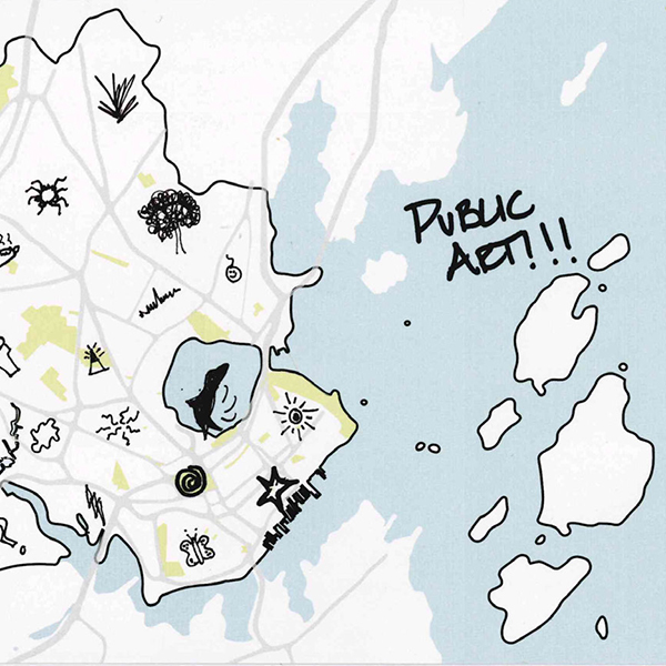
Since 2017, The Portland Society for Architecture has been using blank maps of Portland, Maine as a tool for citizen engagement. This project, called “Mapping Portland: The Complete City,” provides the platform to collect ideas and inspiration about our city: what we love, what we don’t, and what we can imagine. To date more than 350 maps have been collected and cataloged from high school students to senior citizens, new Mainers to salty trawlers, each telling a unique story directly tied to our shared place and community. They are honest, wildly imaginative, and extremely inspiring — and we continue to add more. With more public citywide mapping exercises, charrettes, and school activities planned the project has just begun.
In October 2019, the Portland Society of Architects will collaborate with the University of New England Art Gallery and the Center for Global Humanities to exhibit maps collected to date. The maps will be accompanied with entries for the Portland Society of Architects’ inaugural design competition The Complete City: Imagined.